Text Products
Atlantic Tropical Weather Discussion
336
AXNT20 KNHC 021040
TWDAT

Tropical Weather Discussion
NWS National Hurricane Center Miami FL
1215 UTC Wed Sep 2 2026

Tropical Weather Discussion for North America, Central America
Gulf of America, Caribbean Sea, northern sections of South
America, and Atlantic Ocean to the African coast from the
Equator to 31N. The following information is based on satellite
imagery, weather observations, radar and meteorological analysis.

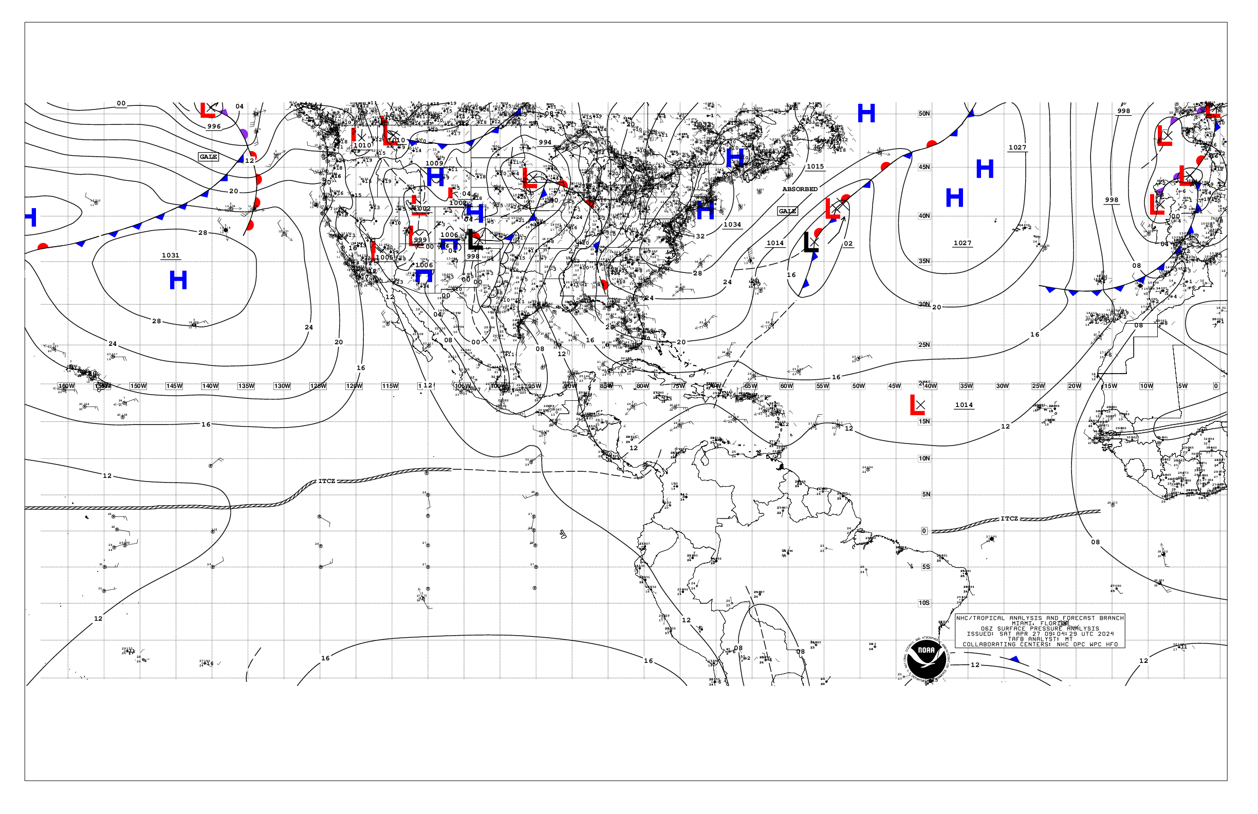
Based on 0600 UTC surface analysis and satellite imagery through
1030 UTC.

...TROPICAL WAVES...

An eastern Atlantic tropical wave is along 40W, south of 20N,
moving westward at 15-20 kt. Refer to the monsoon trough section
for convection info.

A well-defined tropical wave in the central Atlantic is along
55W, south of 23N, moving westward at 15 kt. The wave is
interacting with an upper level trough to it's west, and producing
scattered moderate convection along the wave axis and N of 18N.
Recent satellite scatterometer data has shown a very sharp
surface trough with this wave, with fresh to strong winds from
15N to 21N between 47W and 53W and moderate seas.

...MONSOON TROUGH/ITCZ...

The monsoon trough enters the Atlantic through the coast of
Mauritania near 19N16W and continues southwestward to 11N20W to
09N47W. The ITCZ extends from 10N54W to 09N61W. Scattered moderate
convection is from 06N to 15N between 31W-42W.

...GULF OF AMERICA...

In the wake of Tropical Depression Edouard, which continues
to move N away from the area, a weak pressure gradient prevails
across the basin. Moderate or weaker anticyclonic winds and
slight seas are noted over most of the Gulf waters. Fresh NE
winds prevail across the coastal waters NW and W portions of the
Yucatan Peninsula.

For the forecast, weak high pressure will prevail across the Gulf
allowing for moderate or weaker winds and slight to moderate
seas.

...CARIBBEAN SEA...

An upper level low from the Cayman Islands to NW Cuba continues to
combine with ample low level moisture moving in from the southeast
to produce lingering scattered showers and thunderstorms over
eastern Cuba, western Haiti and the surrounding waters between the
SE Bahamas and Jamaica. A surface trough extends from central
Cuba to near 20N81W. Scattered showers and isolated thunderstorms
also prevail across SW portions and into the coastal waters of NE
Nicaragua and Honduras, behind a tropical wave exiting Central
America and moving into the eastern Tropical Pacific. Weak Bermuda
High pressure north of the basin is promoting a modest pressure
gradient to the south, and yielding moderate to fresh easterly
trade winds across the central and east-central Caribbean between
63W and 75W, per recent satellite scatterometer data. Seas are 4
to 7 ft across these waters. Moderate easterly winds and moderate
seas prevail elsewhere the eastern Caribbean. Elsewhere, light to
gentle winds and slight seas are prevalent W portions, except for
moderate winds across the Gulf of Honduras.

For the forecast, the trough will continue moving WNW through
Thu. Elsewhere across the basin, the pressure gradient between the
subtropical ridge and relatively lower pressure in northern South
America will continue to sustain fresh to strong trades along
with moderate seas over the central and eastern Caribbean through
the next few days, while moderate or weaker winds and slight to
moderate seas remain over the remainder of the basin.

...ATLANTIC OCEAN...

A low to middle level trough extends from near Bermuda to the NW
Bahamas and the SE Florida coastal waters. Meanwhile, another low
level trough is moving across eastern Cuba and the SE Bahamas,
with abundant low level moisture behind it. These feature are
combining to produce scattered moderate isolated strong convection
from the NW Bahamas to just SW of Bermuda, and across the coastal
waters of NE and central Cuba, that is being sustained by
divergent flow aloft associated with an upper level low over the
Florida Panhandle. Scattered moderate convection also continues
across the near and offshore waters of Florida W of 78W. Moderate
SE surface winds generally prevail from 70W to the Bahamas as
well as S of 25N between 65W and 70W, were seas are 4 to 6 ft.

The remainder of the tropical Atlantic is dominated by a broad
subtropical ridge centered southwest of the Azores, anchored on a
1026 mb high near 34N33W. Moderate to fresh easterly winds and
moderate seas are found S of 25N between 30W and 65W. Meanwhile,
fresh to strong northerly winds and moderate to rough seas are
present north of 18N and east of 27W off Morocco and NW Mauritania
and the Canary Islands and into the eastern Atlantic. Light to
gentle winds and slight seas prevail elsewhere N of 25N.

For the forecast west of 55W, the trough will continue moving WNW
through Thu. Elsewhere, abundant deep tropical moisture will
continue to help sustain scattered showers and isolated
thunderstorms W of 63W through today. Otherwise, the subtropical
ridge will dominate, supporting mainly moderate or weaker winds
and moderate seas over the forecast waters.

$$
ERA